
Repair the cauldron (补锅) is an Hunan province huāgǔxì (花鼓戏, flowers and drums opera) popular opera style. thus kind of opera is also widly spread in nearest provinces.
Comments Off
Repair the cauldron (补锅) is an Hunan province huāgǔxì (花鼓戏, flowers and drums opera) popular opera style. thus kind of opera is also widly spread in nearest provinces.
 Version française
  English version
  中文译文
中文译文
Hanggai (in mongolian cyrillic : Хангай) is a chinese group of mongolian origin of Beijing. They mix traditional mongol music (in mongole langage Morin khuur, overtone singing… electric guitar and punk-rock) like 80’s European alternative rock.
Nederland, Drinklied/Netherland, Dring song
Longer concert in United states:
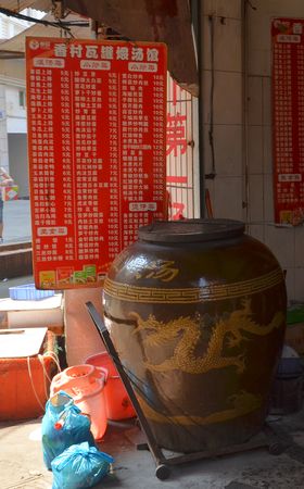
I was on wikipedia uploading a picture taken in wagang (瓦缸, a big jar) restaurant, I then searched appropriated category on commons for french term “jarre”, and found it was about english term “jar” that is today translated by “bocal” in french. In french jarre is more about big container like chinese wagang or greek phitos, searching to sort and categorize some commons pictures, and found a picture about women trading jarres in Gorom-Gorom market. Gorom-Gorom is a Burkina Faso trade city for nomads of South Sahel (in Burkina Sahel Region. I immediatly think about geotag the picture, using OSM url => {{Location dec}}/{{Object location dec}} wikipedia commons tags.
You can simply do this by taking Openstreetmap url in two step :
1. Click on the place you want the geoposition.
2. Click on permalink, you will get an URL like :
* http://www.openstreetmap.org/?lat=14.445&lon=-0.2326&zoom=12&layers=M
3. Extract lat=$lat and lon=$lon values and paste it in :
* {{Location dec|$lat|$lon}}, here : {{Location dec|14.445|-0.2326}}
for camera position, and :
* {{Object location dec|$lat|$lon}}, here : {{Object location dec|14.445|-0.2326}}
for object position.
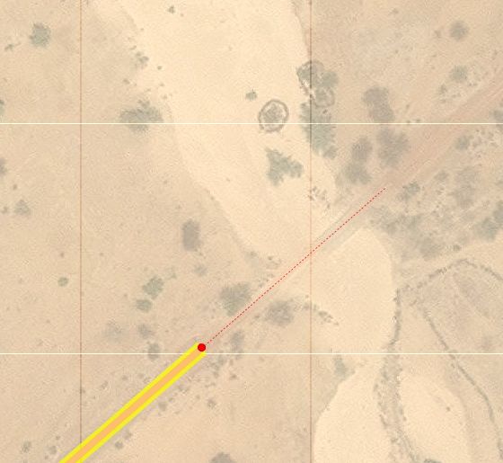
Well, this was not really precise, no aerial photography of the place, only satellite one. But I moved a little and seen, that now, big parts of Burkina Faso have aerial photography on Bing Imagery layer for Potalatch (the web OSM editor).
I then started to route some roads, street and water pieces. This is unusual to draw tracks in desert for me, that mostly drawn, the 2*2 to 2*5 lanes (+2 sides lanes and footway and bikeways) asphalted streets in China. In this countries all road are one lane for two ways.
Here are some information I noticed, that could help other OSMers to draw thoses areas (Sahel in some poor sub-saharian countries) :
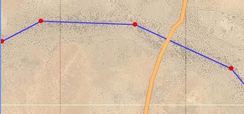
In most of the Burkina Faso, the tag higwhay=track should be avoided, as most road but perhaps 10 national roads are not in asphalt. They should be classified by distance and function. Perhaps trunk for national (only one asphalted), primary for biggest intercity roads, secondary for smaller cities intercity roads, etc…
* In the Sahel region (North East of the Burkina Faso), most roads are only tracks slightly browner or marked by stones along the sides of the road. There is bush areas and pure sand areas.
* In the Sahel region, water of the rivers are rarely seen from sky, only a slightly more green area indicate there is water underground.
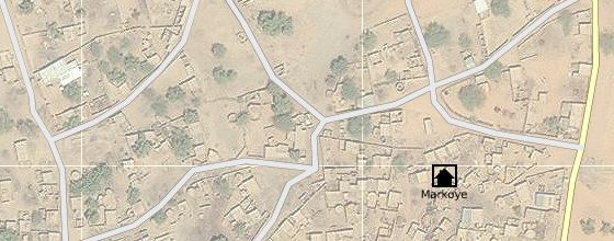
* Markoye, in the far North of the Burkina Sahel Region, as most Burkina small cities in this region, that’s not easy to trace. I question myself to know if that’s better to draw roads on lighter parts of the streets (because of sand moved by feets ?), or to only draw houses, walls and trees, possible ways then appear by themselves. Is there any local code about what is in the family house, and what is outside ? I will probably ask soon to Burkinabe friends.
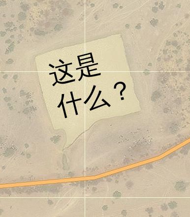
* For the fun, at Markoye, there is 2 natural lakes, and an artificial water lake, looking like a square Speech balloon (phylactère) lake:
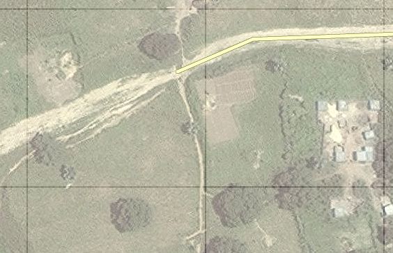
I after that moved in Ouagadougou, the capital, in Centre Region, and its green tropical area, the roads are often destroy by water here, there is big ponds in the middle of the raod, but this is generally more easy to trace :
Version en français
After a first article on WebGL, I come back on this topic for real usage.
Use in dev version of WebGL on Fennec (mobile firefox), go in about:config, fiter webgl, switch webgl.force-enable to true
On Linux plateform, no problem with Nvidia or ATI proprietary driver. On intel you should use Mesa 8.0. It’s available for ubuntu on ppa:xorg-edgers/ppa
* Firefox 11 (beta) and a plugin for older version called Tilt allow to see in 3d web pages structures accelerating vizualisation, interaction and bug finiding for webmasters.
Pyppet – WebGL Streaming blender< =>WebGL allow a realtime WebGL rendered visualisation in web browser of a scene in modelization process pipled from Blender.
minifier of GLSL files allow to comprress the size of a GLSL script, and then to accelerate web transfert and reduce bandwith.
As I thinked of WebGL as a good tool for some vizualisation in Wikipedia, Google, done an anatomic vizualisation tool. It allow in démos to see a human corpse with ZygotBody and a cow with Google Open-3d-viewer. Code source is available at Project page.
Augmented Reality sample from firefox project.
Cloudmach cloud WebGL games plateform
Seriously.js, realtime compositing on a vidéo.
lights.elliegoulding.com a nice demo.
Crazy bugs a nice puzzle.
Using WebGL for vector and 2D bitmap rendering and use fast and energy efficient hardware acceleration in interactve appliactions : WebGL Fundamentals (WebGL is a 2D API!)
Powered by WordPress


